
Stiefel Organizational map of Germany, for pinning to German (48617)
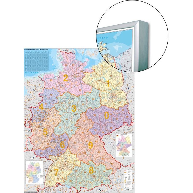
This Stiefel organizational map of Germany is designed for practical use in offices, classrooms, or logistics environments where clear regional and postal code information is needed. The map is printed in German and features up-to-date political boundaries as well as detailed postcode regions. Its surface is suitable for pinning, making it easy to mark important locations or routes for planning and organization. The large format ensures that all details are easy to read and reference.
1638 kr net price (non-EU countries)
Anatolii Livashevskyi
Product Manager![]() /
/ ![]()
+48721808900![]() +48721808900
+48721808900![]() +48721808900
+48721808900
[email protected]
Description
This Stiefel organizational map of Germany is designed for practical use in offices, classrooms, or logistics environments where clear regional and postal code information is needed. The map is printed in German and features up-to-date political boundaries as well as detailed postcode regions. Its surface is suitable for pinning, making it easy to mark important locations or routes for planning and organization. The large format ensures that all details are easy to read and reference.
This map is ideal for anyone needing a current, interactive map of Germany that combines political and postal code data for effective planning and organization.
Product Specifications
General Information
-
Type: Country map
-
Subject: Germany
-
Material: Paper
-
Width: 97 cm
-
Height: 119 cm
Map Features
-
Language: German
-
Up-to-date: Yes, includes the latest information
-
Scale: 1:3,600,000
-
Map Type: Political
-
Zip-code Map: Yes, includes postcode information
Special Features
-
3D Map: No