
Stiefel Map Germany organizational chart for pinning to, also magnetic German (48618)
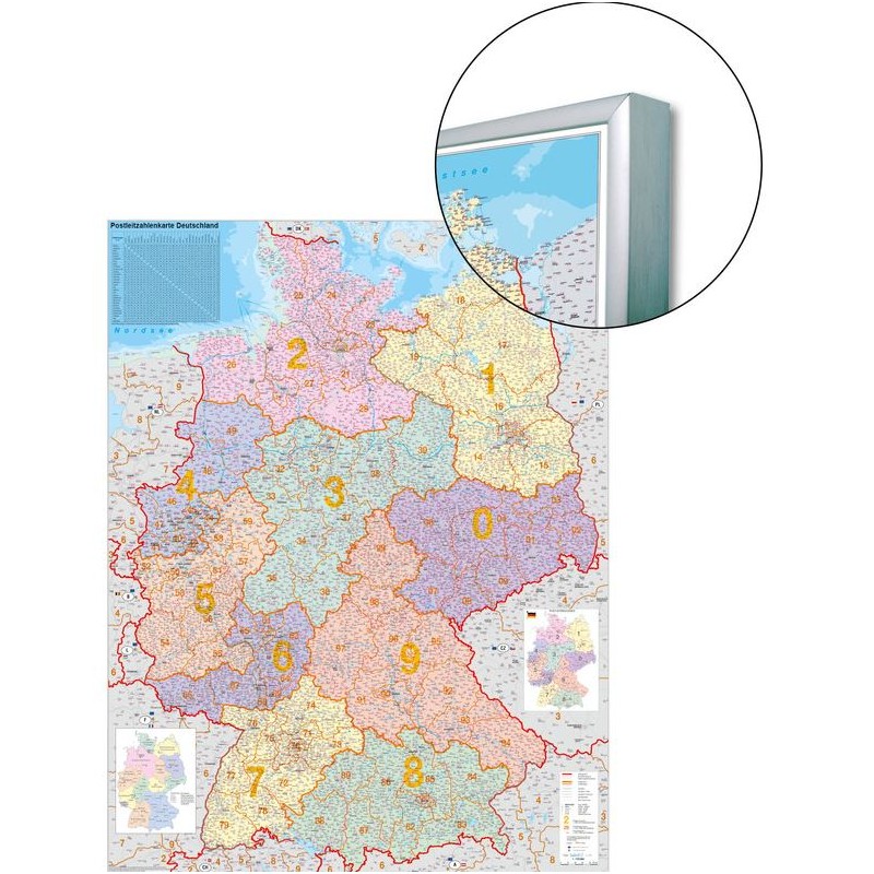
This Stiefel organizational map of Germany is designed for flexible use in offices, classrooms, and planning environments. The map is printed in German and features up-to-date political boundaries as well as detailed postcode regions, making it ideal for logistics, distribution, and organizational tasks. Its surface is both magnetic and pinnable, allowing you to use pins or magnets for marking important locations or routes. The map is available in a version that includes a frame for added convenience and durability.
380.03 BGN net price (non-EU countries)
Anatolii Livashevskyi
Product Manager![]() /
/ ![]()
+48721808900![]() +48721808900
+48721808900![]() +48721808900
+48721808900
[email protected]
Description
This Stiefel organizational map of Germany is designed for flexible use in offices, classrooms, and planning environments. The map is printed in German and features up-to-date political boundaries as well as detailed postcode regions, making it ideal for logistics, distribution, and organizational tasks. Its surface is both magnetic and pinnable, allowing you to use pins or magnets for marking important locations or routes. The map is available in a version that includes a frame for added convenience and durability.
This map is perfect for anyone needing a versatile, interactive map of Germany that supports both pinning and magnetic use, with comprehensive political and postcode data.
Product Specifications
General Information
-
Type: Country map
-
Subject: Germany
-
Width: 97 cm
-
Height: 119 cm
Map Features
-
Language: German
-
Up-to-date: Yes, includes the latest information
-
Scale: 1:3,600,000
-
Map Type: Political
-
Zip-code Map: Yes, includes postcode information
Special Features
-
Magnetic: Yes, suitable for use with magnets
-
3D Map: No
-
Map Service (Optional): Magnetic version available, including frame