English
 Čeština
 Русский
 Deutsch
 Français
 Italiano
 Español
 Nederlands
 日本語
日本語 Svenska
 Dansk
Dansk Türkçe
 Bokmål
 中文
中文 Română
 български език
 Magyar
 Lietuvių kalba
 Slovenčina
 ελληνικά
 اللغة العربية
 Українська
 Suomi
Suomi Português PT
 Eesti keel
 עברית
עברית Latviešu valoda
 Slovenščina
 Hrvatski
 हिन्दी
 বাংলা
বাংলা Bahasa Indonesia
 繁體中文
繁體中文 한국어
한국어 Íslenska
 Tiếng Việt
 فارسى
فارسى ภาษาไทย

chevron_left
chevron_right
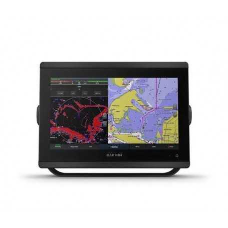
Garmin GPSMAP 8612 with Bluechart G3 & LakeVü G3 Maps
Discover the Garmin GPSMAP 8612, a compact yet powerful chartplotter and sonar combo that redefines marine navigation. Equipped with advanced BlueChart G3 and LakeVü G3 maps, it offers exceptional detail for both coastal and inland waters. Easy to install and use, this Multifunction Display (MFD) ensures seamless navigation and superior performance. Part of the renowned Garmin marine lineup with part number 010-02092-01, it combines cutting-edge technology with unmatched user convenience. Elevate your boating adventures with the reliable and high-performance Garmin GPSMAP 8612.
Karol Łoś
Product Manager /
/ 
+48603969934 +48507526097
[email protected]
Description
Garmin GPSMAP 8612 Marine Chartplotter with BlueChart G3 & LakeVü G3 Maps
Discover unparalleled marine navigation with the Garmin GPSMAP 8612, a high-performance chartplotter equipped with premium mapping and sonar capabilities. Designed for serious mariners, this device offers everything you need to navigate safely and efficiently.
Key Features:
- Full HD IPS Touchscreen: Enjoy wider viewing angles and superior clarity with a sunlight-readable display, available in 10”, 12”, or 16” sizes.
- Built-in Sonar Capabilities: See below and around your boat with support for 1-kW Dual-Channel CHIRP traditional sonar, ClearVü, and SideVü scanning sonars (transducers sold separately).
- Advanced Connectivity: Connect seamlessly with ANT® technology, Wi-Fi®, and the Garmin Marine Network for a comprehensive marine system.
- SmartMode™ Station Controls: Get quick, one-touch access to vital information, optimizing your response in high-stress situations.
- Preloaded Mapping: Navigate with confidence using preloaded BlueChart® g3 coastal charts and LakeVü g3 inland maps, featuring integrated Garmin and Navionics® content.
- Optional Charts and Maps: Enhance your experience with optional Garmin Navionics+™ or premium Garmin Navionics Vision+™ cartography.
- Garmin SailAssist™ Features: Streamline your sailing with features like laylines, race start line guidance, and enhanced wind data.
Installation and Controls:
- Simple Mounting Options: Install multiple displays flat or flush for a sleek, modern helm.
- GRID™ 20 Remote Control: Optional remote input device for intuitive control over your marine system.
- OneHelm™ Feature: Integrate third-party devices into a single control interface.
In the Box:
- GPSMAP 8612
- Power cable
- NMEA 2000® drop cable
- NMEA 2000 T-connector
- Bail mount with knobs
- Flush mount kit
- Sun cover
- Trim piece snap covers
- Documentation
Specifications:
General
- Dimensions: 11.9" x 8.5" x 3" (30.3 cm x 21.6 cm x 7.6 cm)
- Weight: 6.0 lbs (2.7 kg)
- Waterproof: IPX7
- Display Size: 10.1" x 5.7"; 11.6" diagonal, 25.7 cm x 14.5 cm; 29.5 cm diagonal
- Display Resolution: 1920 x 1200 pixels
- Display Type: FHD, IPS
Maps & Memory
- Accepts Data Cards: 2 microSD cards
- Waypoints: 5000
- Tracks: 50 saved tracks
- Navigation Routes: 100
Connectivity
- NMEA 2000 Ports: 1
- Video Input Ports: 1 (BNC composite); 1 HDMI (HDCP compliant)
- USB Ports: Yes
- Bluetooth® Calling: Yes
- ANT+ (Connectivity): Yes
- Garmin Wi-Fi Network (Local Connection): Yes
Power
- Power Input: 10-32 Vdc
- Typical Current Draw at 12 VDC: 1.3 A
- Maximum Power Usage at 10 VDC: 45W
With its robust features and cutting-edge technology, the Garmin GPSMAP 8612 is the ultimate chartplotter for any mariner. Enhance your navigation experience today!
Data sheet