
Our company is involved in preparing official permits from the Polish Ministry of Development and Technology, which allows us to export all dual-use drones, optics, and portable radiophones without VAT on the Polish side / and without VAT on the Ukrainian side.
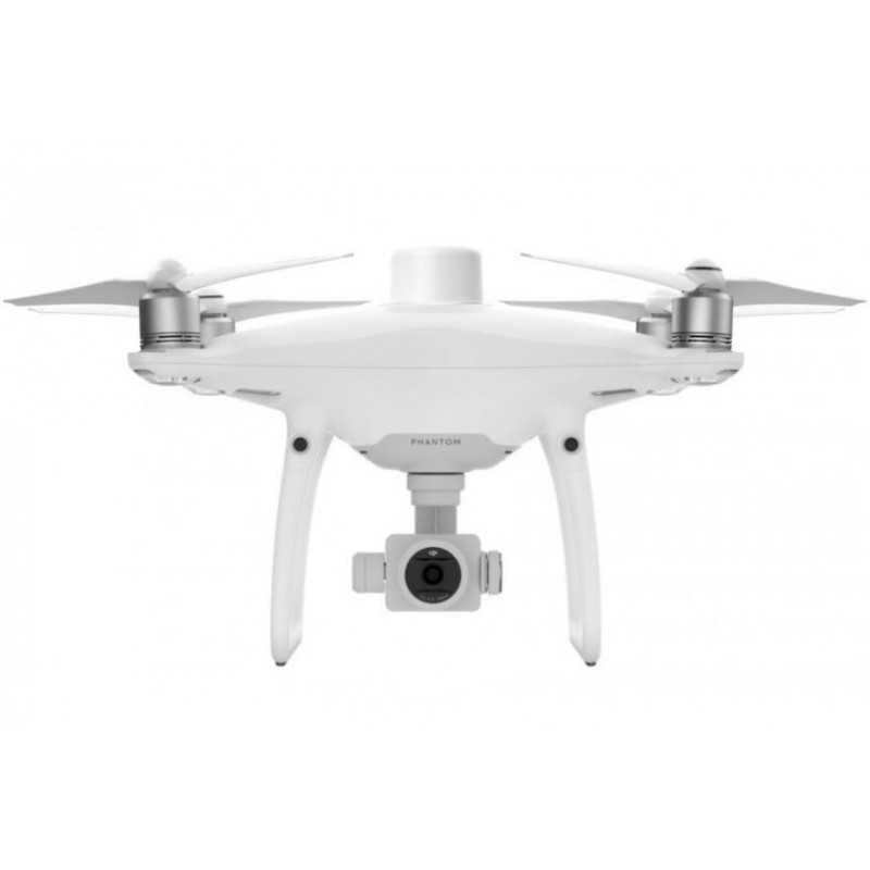
DJI Phantom 4 RTK (EU) Combo + Ent Shield Basic
Viktoriia Turzhanska
Product Manager![]() /
/ ![]()
+48723706700![]() +48723706700
+48723706700![]() +48723706700
+48723706700
[email protected]
Anatolii Livashevskyi
Product Manager![]() /
/ ![]()
+48721808900![]() +48721808900
+48721808900![]() +48721808900
+48721808900
[email protected]
Michał Skrok
Product Manager
![]() /
/ ![]()
+48721807900![]() +48721807900
+48721807900
[email protected]
Description
DJI Phantom 4 RTK (EU) Combo + Ent Shield Basic: Advanced Mapping Drone
Next Generation Mapping
Experience a revolution in drone technology with DJI's Phantom 4 RTK, designed to deliver unprecedented accuracy for mapping and surveying tasks. This state-of-the-art drone offers centimeter-level precision, reducing the need for ground control points and ensuring reliable data collection.
Key Features
- Centimeter-Level Positioning System:
Integrated RTK module for real-time, high-precision data. The Phantom 4 RTK supports seamless integration with the D-RTK 2 High Precision GNSS Mobile Station and NTRIP via 4G dongle or WiFi.
- TimeSync for Accurate Data:
The innovative TimeSync system ensures alignment between the flight controller, camera, and RTK module, providing optimal results for photogrammetric methods.
- High-Quality Imaging:
Equipped with a 1-inch, 20-megapixel CMOS sensor and mechanical shutter, the Phantom 4 RTK captures sharp images with a ground sample distance (GSD) of 2.74 cm at 100 meters. Each camera lens is individually calibrated for enhanced accuracy.
- Designed for Surveyors:
Offering survey-grade results with efficient control schemes, the DJI Phantom 4 RTK is built for professional surveying and mapping tasks.
- Purpose-Built Application:
The DJI GS RTK app provides an intuitive interface for mission planning and execution, with modes for Photogrammetry, Waypoint Flight, Terrain Awareness, and more. The built-in 5.5-inch HD display enhances mission planning and execution.
- Third-Party App Compatibility:
Access a wide range of third-party applications via the SDK Remote Controller, allowing for expanded functionality and customization.
- OcuSync Transmission System:
Enjoy stable HD image and video transmission over distances up to 7 km, ideal for large-scale mapping projects.
- Seamless D-RTK 2 Mobile Station Compatibility:
Enhance your Phantom 4 RTK's capabilities with the D-RTK 2 Mobile Station for accurate real-time differential data and reliable surveying solutions.
- Comprehensive Mapping Solution:
With built-in flight planning and RTK data collection capabilities, the Phantom 4 RTK is ready to support any mapping, surveying, or inspection workflow right out of the box.
Specifications
- Aircraft:
- Takeoff Weight: 1391 g
- Max Speed: 31 mph (50 kph) in P-mode
- Max Flight Time: Approx. 30 minutes
- Operating Temperature Range: 32° to 104° F (0° to 40℃)
- Camera:
- Sensor: 1" CMOS, 20 MP
- ISO Range: Video: 100-3200, Photo: 100-12800
- Max Image Size: 4864×3648 (4:3)
- Intelligent Flight Battery:
- Capacity: 5870 mAh
- Voltage: 15.2 V
- Remote Controller:
- Operating Frequency: 2.400 GHz to 2.483 GHz (Europe, Japan, Korea), 5.725 GHz to 5.850 GHz (Other regions)
- Display: 5.5 inch, 1920×1080, 1000 cd/m²
Take your mapping and surveying projects to the next level with the DJI Phantom 4 RTK, combining cutting-edge technology with user-friendly design for professional results.
Data sheet

Official permits of the Ministry of Development and Technology
Our company is involved in preparing official permits from the Polish Ministry of Development and Technology, which allows us to export all dual-use drones, optics, and portable radiophones without VAT on the Polish side / and without VAT on the Ukrainian side.