
Our company is involved in preparing official permits from the Polish Ministry of Development and Technology, which allows us to export all dual-use drones, optics, and portable radiophones without VAT on the Polish side / and without VAT on the Ukrainian side.
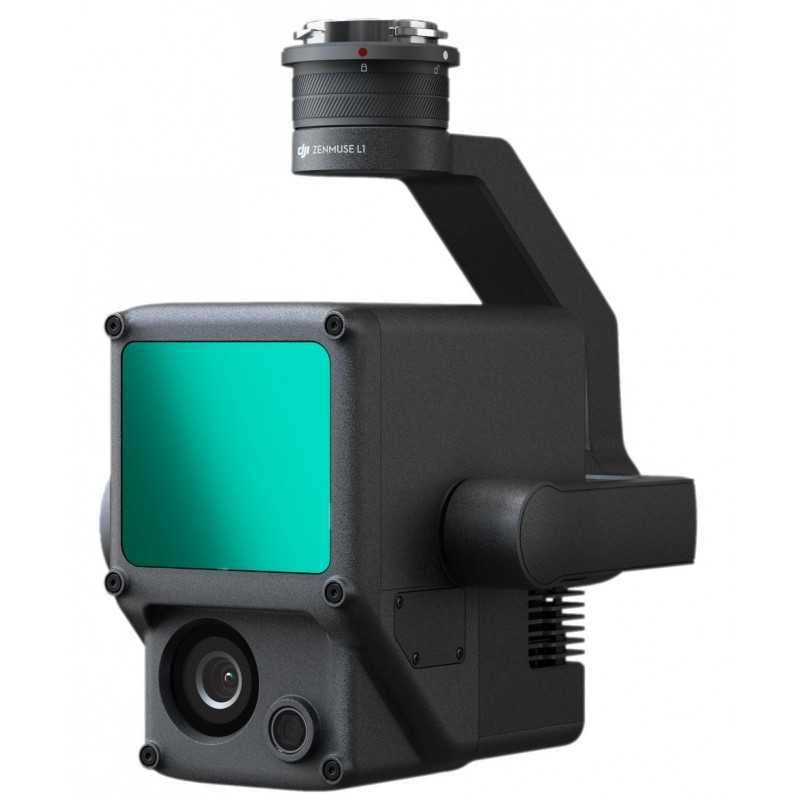
DJI Zenmuse L1 + DJI Terra Lifetime License
33788.29 AED net price (non-EU countries)
Viktoriia Turzhanska
Product Manager![]() /
/ ![]()
+48723706700![]() +48723706700
+48723706700![]() +48723706700
+48723706700
[email protected]
Anatolii Livashevskyi
Product Manager![]() /
/ ![]()
+48721808900![]() +48721808900
+48721808900![]() +48721808900
+48721808900
[email protected]
Michał Skrok
Product Manager
![]() /
/ ![]()
+48721807900![]() +48721807900
+48721807900
[email protected]
Description
DJI Zenmuse L1 + DJI Terra Lifetime License: Complete Aerial Surveying Solution
6 Months Free of DJI Terra!
Your All-in-One Lidar and RGB Solution for Advanced Aerial Surveying
The DJI Zenmuse L1 is a comprehensive aerial surveying tool that combines a high-precision Livox Lidar module, an advanced IMU, and an RGB camera equipped with a 1-inch CMOS sensor, all stabilized on a 3-axis gimbal. Paired with the Matrice 300 RTK and DJI Terra, the L1 delivers real-time, detailed 3D data for precise and efficient surveying tasks, capturing complex structures with high accuracy.
- Integration of Lidar, RGB camera, and high-accuracy IMU
- High Efficiency: Covers 2 km2 in a single flight
- Precision: Vertical Accuracy - 5 cm, Horizontal Accuracy - 10 cm
- Impressive Point Rate: 240,000 points per second
- Supports 3 Return Modes
- Detection Range: Up to 450 meters
- Durable: IP54 Ingress Protection for challenging environments
- Real-Time Point Cloud LiveView
Efficiency and Accuracy Redefined
Generate vibrant, true-color point cloud models in real-time and gather up to 2 km2 of data in a single flight using the Livox Lidar module, featuring a 70° field of view and a high-resolution RGB camera. Achieve centimeter-level accuracy using the integrated IMU, vision sensor, and GNSS data.
Weather-Ready Operation
With an IP54 rating, the Zenmuse L1 is operational even in rain and fog. Its active Lidar scanning allows for night flights, ensuring data collection without interruption.
Explore the Features
Livox Lidar Module
- Frame Lidar for 100% effective point cloud results
- Detection Range: 450m at 80% reflectivity; 190m at 10% reflectivity
- Effective Point Rate: 240,000 pts/s
- Non-repetitive and repetitive scanning patterns
RGB Camera
- 20 MP with 1-inch CMOS sensor
- Mechanical Shutter for high-speed captures
High-accuracy IMU
- Vision Sensor for precise positioning
- GNSS, IMU, and RGB Data Fusion for comprehensive accuracy
Application Scenarios
- Topographic Mapping: Rapid generation of topographic maps with accurate digital elevation models.
- AEC and Surveying: Manage projects with high-accuracy point clouds and 3D models.
- Emergency Response: Acquire critical insights in real-time at any hour.
- Law Enforcement: Obtain real-time situational awareness for on-site decisions.
- Energy and Infrastructure: Detailed modeling of structures for efficient management.
- Agriculture and Forestry Management: Gain insights into vegetation density, stock volume, and growth trends.
Technical Specifications
General
- Product Name: Zenmuse L1
- Dimensions: 152×110×169 mm
- Weight: 930±10 g
- Power: Typical 30 W; Max 60 W
- IP Rating: IP54
- Supported Aircraft: Matrice 300 RTK
- Operating Temperature: -20° to 50° C
- Storage Temperature: -20° to 60° C
System Performance
- Detection Range: 450 m at 80% reflectivity
- Point Rate: Max 240,000 pts/s
- System Accuracy: Horizontal 10 cm, Vertical 5 cm at 50 m
- Real-time Point Cloud Coloring: Reflectivity, Height, Distance, RGB
Lidar
- Ranging Accuracy: 3 cm at 100 m
- Scan Modes: Non-repetitive and repetitive patterns
- Laser Safety: Class 1 (Eye Safe)
RGB Mapping Camera
- Effective Pixels: 20 MP
- Focal Length: 8.8 mm / 24 mm (Equivalent)
- Shutter Speed: Mechanical 1/2000 - 8 s, Electronic 1/8000 - 8 s
- ISO Range: Video 100 – 3200, Photo 100 - 12800
DJI Terra: Your Digital Asset Creator
DJI Terra is the premier mapping software for transforming real-world data into actionable digital assets. Capture, analyze, and visualize environments with ease, whether for topographic mapping, construction management, or emergency response.
Key Features:
- Real-time 3D Mapping
- Efficient Mission Planning
- Detailed Inspection and Analysis
Embrace the future of surveying with the DJI Zenmuse L1 and DJI Terra, offering unmatched efficiency, accuracy, and versatility for all your aerial mapping needs.
Data sheet

Official permits of the Ministry of Development and Technology
Our company is involved in preparing official permits from the Polish Ministry of Development and Technology, which allows us to export all dual-use drones, optics, and portable radiophones without VAT on the Polish side / and without VAT on the Ukrainian side.