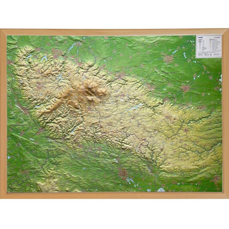


Georelief Harz 3D relief map with brown wooden frame (77 x 57 cm) (in German) (80207)
The Georelief 3D Relief Map of the Harz Mountains is a detailed and visually engaging representation of this beautiful German region. With its three-dimensional physical relief, the map highlights the terrain's features, making it ideal for educational purposes, professional use, or as a decorative addition to any space. The wooden frame and laminated surface ensure durability and a polished appearance, making it suitable for homes, offices, or classrooms.
102.14 $ net price (non-EU countries)
Anatolii Livashevskyi
Product Manager![]() /
/ ![]()
+48721808900![]() +48721808900
+48721808900![]() +48721808900
+48721808900
[email protected]
Description
The Georelief 3D Relief Map of the Harz Mountains is a detailed and visually engaging representation of this beautiful German region. With its three-dimensional physical relief, the map highlights the terrain's features, making it ideal for educational purposes, professional use, or as a decorative addition to any space. The wooden frame and laminated surface ensure durability and a polished appearance, making it suitable for homes, offices, or classrooms.
Specifications:
General:
-
Type: Regional map
-
Subject: Harz Mountains
-
Material: Synthetic material
-
Width: 77 cm
-
Height: 57 cm
-
Depth: 1.5 cm
-
Framing: Wood frame
Map Features:
-
Up-to-Date Map Features: Yes
-
Language: German
-
Map Type: Physical relief map
-
Scale: 1:110,000
-
Exaggeration Factor (Überhöhungsfaktor): 1.5
Special Features:
-
3D Map: Yes
-
Suspension: Yes (ready to hang)
-
Laminated Surface: Yes
-
Magnetic Surface: No
-
Pinnable Surface: No
-
Zip-Code Map: No
This map provides an accurate and captivating view of the Harz Mountains' topography. The wooden frame adds a classic and durable touch, making it a standout piece for display in any environment.