


Stiefel Continental map Europe postcode (97 x 119 cm) German (73433)
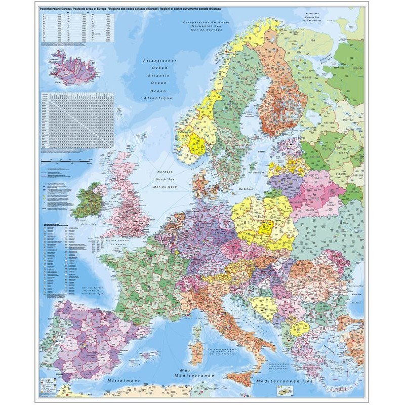
This Stiefel continental map of Europe is designed for detailed organizational and planning purposes, especially where postcode information is important. The map is mounted on rigid foam and framed with aluminum, providing both durability and a professional appearance. It is printed in German and includes up-to-date political and postcode data, making it ideal for logistics, distribution, or educational use. The surface is laminated for extra protection and is pinnable, allowing you to mark locations easily.
169.14 $ net price (non-EU countries)
Anatolii Livashevskyi
Product Manager![]() /
/ ![]()
+48721808900![]() +48721808900
+48721808900![]() +48721808900
+48721808900
[email protected]
Description
This Stiefel continental map of Europe is designed for detailed organizational and planning purposes, especially where postcode information is important. The map is mounted on rigid foam and framed with aluminum, providing both durability and a professional appearance. It is printed in German and includes up-to-date political and postcode data, making it ideal for logistics, distribution, or educational use. The surface is laminated for extra protection and is pinnable, allowing you to mark locations easily.
This map is perfect for anyone needing a robust, up-to-date, and interactive map of Europe with postcode details for planning and organizational tasks.
Product Specifications
General Information
-
Type: Continent map
-
Subject: Europe
-
Material: Rigid foam
-
Width: 97 cm
-
Height: 119 cm
-
Framing: Aluminum frame
Map Features
-
Reverse Side: No features on the back
-
Language: German
-
Up-to-date: Yes, includes the latest information
-
Scale: 1:3,600,000
-
Map Type: Political
-
Zip-code Map: Yes, includes postcode information
Special Features
-
Suspension: Yes, suitable for hanging
-
Magnetic: No
-
3D Map: No
-
Pinnable: Yes, can be used with pins
-
Laminated: Yes, for extra durability