
Stiefel Germany postal code map, for pinning to German (48613)
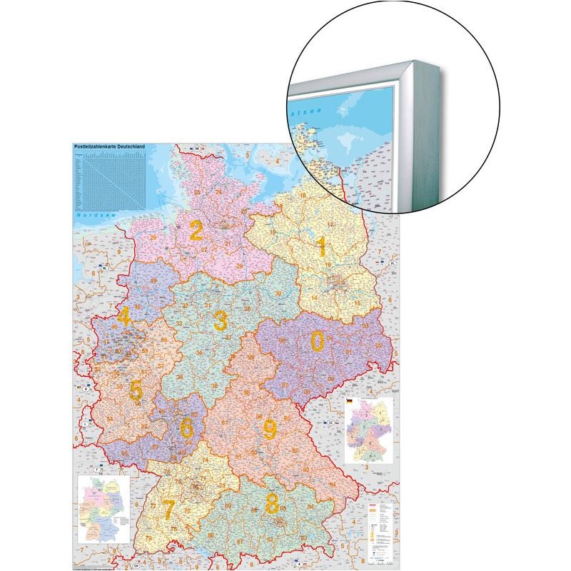
This Stiefel Germany postal code map is designed for practical use in offices, classrooms, and logistics environments where accurate regional and postal code information is essential. The map is printed in German and features up-to-date political boundaries along with detailed postcode regions. Its surface is suitable for pinning, allowing you to mark important locations, routes, or areas for organizational and planning purposes. The clear layout and convenient size make it easy to reference and use in a variety of settings.
169.14 $ net price (non-EU countries)
Anatolii Livashevskyi
Product Manager![]() /
/ ![]()
+48721808900![]() +48721808900
+48721808900![]() +48721808900
+48721808900
[email protected]
Description
This Stiefel Germany postal code map is designed for practical use in offices, classrooms, and logistics environments where accurate regional and postal code information is essential. The map is printed in German and features up-to-date political boundaries along with detailed postcode regions. Its surface is suitable for pinning, allowing you to mark important locations, routes, or areas for organizational and planning purposes. The clear layout and convenient size make it easy to reference and use in a variety of settings.
This map is ideal for anyone who needs a current, interactive map of Germany that combines political and postal code data for effective planning and organization.
Product Specifications
General Information
-
Type: Country map
-
Subject: Germany
-
Width: 97 cm
-
Height: 119 cm
Map Features
-
Language: German
-
Up-to-date: Yes, includes the latest information
-
Scale: 1:760,000
-
Map Type: Political
-
Zip-code Map: Yes, includes postcode information
Special Features
-
3D Map: No