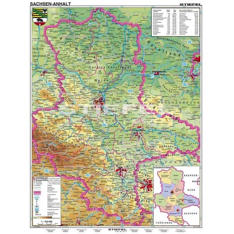

Stiefel Regional map Sachsen-Anhalt physisch German (63997)
This Stiefel regional map of Saxony-Anhalt provides a detailed physical and political overview of the region, making it ideal for educational, professional, or planning purposes. The map is printed in German and features the most current geographical and administrative information. Its large format ensures that all details are easy to read, and an optional lamination service is available for added durability and ease of use. The map is suitable for classrooms, offices, or anyone needing a comprehensive reference for Saxony-Anhalt.
121.22 $ net price (non-EU countries)
Anatolii Livashevskyi
Product Manager![]() /
/ ![]()
+48721808900![]() +48721808900
+48721808900![]() +48721808900
+48721808900
[email protected]
Description
This Stiefel regional map of Saxony-Anhalt provides a detailed physical and political overview of the region, making it ideal for educational, professional, or planning purposes. The map is printed in German and features the most current geographical and administrative information. Its large format ensures that all details are easy to read, and an optional lamination service is available for added durability and ease of use. The map is suitable for classrooms, offices, or anyone needing a comprehensive reference for Saxony-Anhalt.
This map is perfect for anyone seeking a clear and current physical and political map of Saxony-Anhalt, with the option for lamination to enhance durability and usability.
Product Specifications
General Information
-
Type: Regional map
-
Subject: Saxony-Anhalt
-
Material: Paper
-
Width: 120 cm
-
Height: 160 cm
Map Features
-
Language: German
-
Up-to-date: Yes, includes the latest information
-
Map Type: Physical and political
Special Features
-
Time Zones: Not specified
-
3D Map: No
-
Map Service (Optional): Lamination available