

National Geographic World map (279 x 193 cm) English (85714)
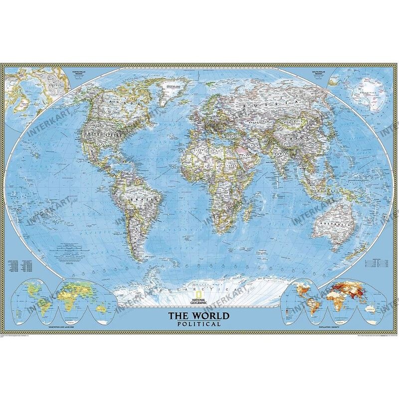
The National Geographic World Map (279 x 193 cm) is a giant-format political map, perfect for displaying in large spaces such as classrooms, offices, or living areas. This map features the classic cartography style of the National Geographic Maps Division, focusing mainly on political boundaries, with physical features indicated by subtle shading. In addition to the main map, four smaller inset maps provide information on the polar regions, global land use, and population density.
237.53 $ net price (non-EU countries)
Anatolii Livashevskyi
Product Manager![]() /
/ ![]()
+48721808900![]() +48721808900
+48721808900![]() +48721808900
+48721808900
[email protected]
Description
The National Geographic World Map (279 x 193 cm) is a giant-format political map, perfect for displaying in large spaces such as classrooms, offices, or living areas. This map features the classic cartography style of the National Geographic Maps Division, focusing mainly on political boundaries, with physical features indicated by subtle shading. In addition to the main map, four smaller inset maps provide information on the polar regions, global land use, and population density.
The map is laminated on both sides with a 0.07 mm glossy polyester film, making it suitable for use with water-soluble pens and self-adhesive stickers, both of which can be removed easily. It is delivered rolled up in a protective plastic tube, and arrives without any manufacturer's watermark. This map does not include a frame and is intended for Europe-centered world reference.
Specifications:
Type: World map
Width: 279 cm
Height: 193 cm
Subject: World, Europe-centered
Material: Paper
Framing: None
Series: Classic
Language: English
Up-to-date map features: Yes
Scale: 1:15,267,000
Map features: Political, time zones
Reverse side features: None
Special features:
-
Time zones included
-
Laminated for writing and easy sticker removal
-
Not magnetic, not pinnable, not 3D, no zip-code information, no calendar
-
No suspension or design map features