
Garmin GPSMAP 86s (010-02235-00) Marine Handheld Preloaded with Worldwide Basemap
Karol Łoś
Product Manager
![]() /
/ ![]()
+48603969934![]() +48507526097
+48507526097
[email protected]
Description
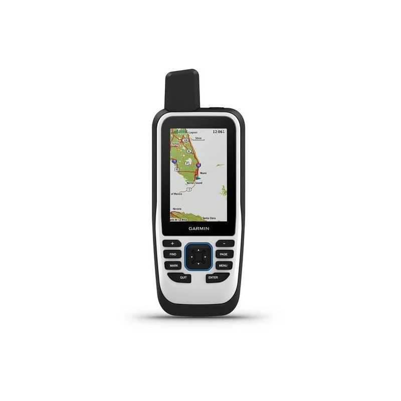
Garmin GPSMAP 86s Marine Handheld GPS with Worldwide Basemap and BlueChart® g3 Compatibility
Part Number: 010-02235-00
Experience unparalleled navigation with the Garmin GPSMAP 86s Marine Handheld GPS. Designed for marine enthusiasts, this robust handheld device is your perfect companion for all water adventures. Preloaded with a worldwide basemap and compatible with BlueChart® g3 coastal charts, it offers enhanced fishing and navigation capabilities.
Key Features
- Water-Resistant and Floats: Designed to withstand marine environments, ensuring durability and reliability.
- Boat Data Streaming: View all your marine system info at a glance by syncing with compatible Garmin chartplotters and instruments.
- Autopilot and Fusion® System Control: Conveniently control your boat’s autopilot and onboard Fusion marine products remotely.
- Smart Notifications: Receive notifications directly on your device when paired with your smartphone, allowing you to stow your phone safely.
- Extended Battery Life: Enjoy up to 40 hours of battery life in standard mode and up to 200 hours in expedition mode.
- LED Flashlight: Built-in LED flashlight acts as a beacon for signaling in emergencies.
Advanced Navigation and Mapping
- Worldwide Basemap: Offers shaded relief coverage of oceans, seas, major lakes, and rivers, along with political boundaries and time zone information.
- BlueChart® g3 Compatibility: Optional coastal charts provide cutting-edge coverage, clarity, and detail with integrated Garmin and Navionics data.
- Accurate Tracking: Adjustable GPS filter smooths speed and heading indications over swells for precise tracking.
- Backup Navigation: Ensures peace of mind with reliable backup navigation for fishing, sailing, or cruising.
Robust Sensors
Navigate confidently with the GPSMAP 86s’s array of sensors, including:
- ABC Sensors: Altimeter, barometer, and 3-axis electronic compass for comprehensive environmental awareness.
- High-Sensitivity Receiver: Supports GPS, GLONASS, and Galileo for superior satellite tracking.
Connectivity and Smart Features
- Wireless Connections: Includes Wi-Fi®, ANT+®, and Bluetooth® technology for seamless updates and connections.
- Garmin Explore™ App: Manage your waypoints, tracks, and routes with cloud-based Garmin Explore integration.
Technical Specifications
General Dimensions: 2.65" x 7" x 1.7" (6.75w x 17.8h x 4.4d cm)
Display Size: 3" diagonal (7.6 cm) with 240 x 400 pixels resolution
Weight: 9.59 oz (272 g)
Battery: Rechargeable, internal lithium-ion providing up to 35 hours in 10-minute tracking mode; up to 200 hours in power save mode
Waterproof: Rated IPX7
Memory: 16 GB internal storage with expandable microSD™ card slot (up to 32 GB)
Equip your adventures with the Garmin GPSMAP 86s Marine Handheld GPS for reliable navigation and comprehensive marine data management.