
chevron_left
chevron_right
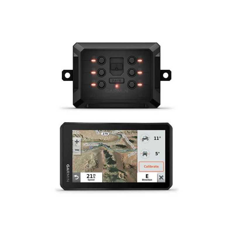
Garmin Tread Base Edition 5.5 Powersport Navigator and Garmin PowerSwitch
Unleash your adventurous spirit with the Garmin Tread Base Edition 5.5 Powersport Navigator. Built for the rugged outdoors, this durable GPS is tailored for powersport enthusiasts, featuring a clear 5.5-inch display to keep you on track. Experience customizable navigation with the integrated Garmin PowerSwitch™ technology, ensuring seamless control over your journey. While this model omits Group Ride Radio features, it remains a robust choice for explorers seeking reliability and precision. Embark on your next off-road adventure with confidence using the Garmin Tread Base Edition.
Description
Garmin Tread Base Edition 5.5" Rugged Powersport Navigator with Garmin PowerSwitch
Embark on your next adventure with the Garmin Tread Base Edition, a durable and versatile powersport navigator designed to tackle all terrains with ease. With the addition of the Garmin PowerSwitch, you gain enhanced control over your powersport vehicle's electronic accessories.
Key Features:
- Rugged and Weather-Resistant: Built to withstand the elements, the Tread navigator features an IPX7 water-resistant rating and meets U.S. military standard 810 for thermal and shock resistance.
- Ultrabright Display: A 5.5" glove-friendly touchscreen ensures visibility in any condition, whether it's bright sunlight or complete darkness. The display can be oriented in portrait or landscape mode.
- Comprehensive Trail Navigation: Enjoy turn-by-turn navigation on unpaved roads and trails with preloaded topographic maps and U.S. Forest Service Roads and Trails.
- BirdsEye Satellite Imagery: Download high-resolution satellite imagery directly to your device via Wi-Fi, no subscription required.
- Public and Private Land Info: Access boundary information for national forests, Bureau of Land Management (BLM) regions, and private lands.
- Easy Device Sync: Use the Tread app to sync waypoints, tracks, and routes across your mobile devices and Tread navigator.
- Mounting and Installation: Securely install on your powersport vehicle with the included powered mount and wiring harness with tube mount.
- ABC Sensors: Includes an altimeter, barometer, compass, and pitch/roll gauges for comprehensive terrain guidance.
- inReach® Compatibility: Pair with compatible inReach devices for satellite communication, including two-way text messaging and SOS alerts.
- Points of Interest: Preloaded with iOverlander™ and Ultimate Public Campgrounds for easy navigation to campsites without a cell signal.
- Music Control: Manage music from your smartphone directly on the navigator’s display via Bluetooth technology.
Product Specifications:
- Dimensions: 5.8”W x 3.5”H x 1”D (14.8 x 8.8 x 2.4 cm)
- Display Size: 5.5” diagonal (13.9 cm) with a resolution of 1280 x 720 pixels
- Weight: 9.2 oz (262 g)
- Battery Life: Up to 6 hours (3.5 hours at 100% backlight)
- Storage: 32 GB internal storage with support for external microSD™ card up to 256 GB
- Sensors: GPS, Galileo, barometric altimeter, compass
- Navigation Features: Turn-by-turn trail navigation, route shaping, speed limit indicators, and more
- Advanced Features: Wi-Fi map updates, smart notifications, and live services via the app
Take your off-road adventures to the next level with the Garmin Tread Base Edition and experience unmatched navigation and control with the Garmin PowerSwitch.
Data sheet

GAX42LT0BE