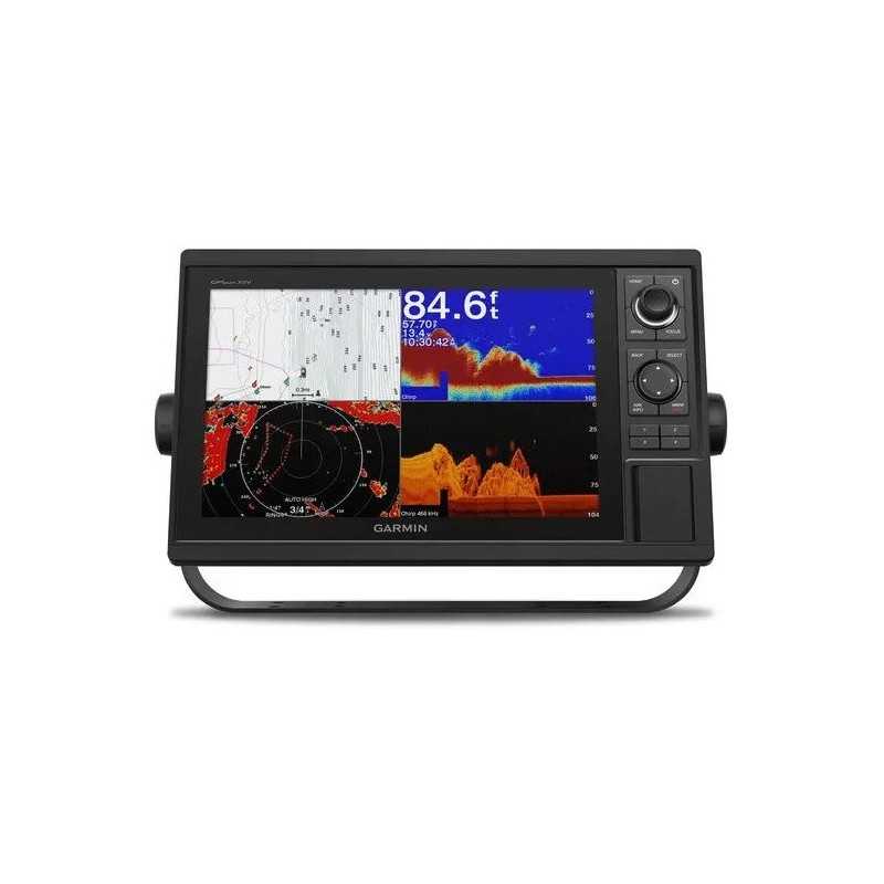

Garmin GPSMAP 1242xsv without Transducer
Karol Łoś
Product Manager
![]() /
/ ![]()
+48603969934![]() +48507526097
+48507526097
[email protected]
Description
Garmin GPSMAP 1242xsv Marine Chartplotter & Sonar Combo
The Garmin GPSMAP 1242xsv is a versatile marine chartplotter and sonar combo designed for serious boaters and anglers. With a large, intuitive 12" color display and comprehensive connectivity, this device offers advanced navigation and sonar features to enhance your maritime adventures.
- Stunning Display: 12” color display with a keypad interface and multifunction control knob for easy navigation.
- Built-in Sonar: Supports Garmin CHIRP sonar, CHIRP ClearVü, and CHIRP SideVü scanning sonars (transducers sold separately).
- Preloaded Charts: Comes with BlueChart® g3 coastal charts and LakeVü g3 inland maps for exceptional coverage and detail.
- High-Sensitivity GPS: Integrated 10 Hz GPS and GLONASS receiver for fast and accurate positioning.
- Network Ready: Fully supports Garmin Marine Network, NMEA 2000®, and NMEA 0183 for expansive connectivity options.
Complete Network Sharing
Share sonar, maps, user data, radar, and more across multiple devices with Garmin Marine Network support. The device also supports NMEA 2000 and NMEA 0183 for seamless integration with autopilots, weather systems, and more.
Comprehensive Sonar Capabilities
Unlock powerful sonar capabilities with the built-in Garmin 1 kW CHIRP sonar, along with CHIRP ClearVü and CHIRP SideVü scanning sonars. Supports Panoptix all-seeing sonar and other premium Garmin sonar modules (transducers sold separately).
Exceptional Garmin Cartography
Equipped with LakeVü g3 and BlueChart® g3, enjoy industry-leading cartographic detail. Add more with accessory maps like LakeVü g3 Ultra and BlueChart g3 Vision for enhanced features and detail.
Seamless Connectivity
Built-in ANT connectivity allows integration with marine watches, transducers, and remote controls. Utilize Wi-Fi® connectivity with the ActiveCaptain® app for smart notifications, map updates, and trip planning.
Advanced Navigation Features
Quickdraw Contours lets you create your own HD maps with 1’ contours. The built-in 10 Hz GPS refreshes your position 10 times per second for smooth navigation.
In the Box
- GPSMAP 1242xsv chartplotter
- Power/data cable
- NMEA 2000 T-connector and drop cable
- Transducer adapter cable
- Bail and flush mount kits
- Protective cover and trim piece snap covers
- Documentation
Technical Specifications
Dimensions: 14.1" x 8.9" x 2.7" (35.8 x 22.6 x 6.9 cm)
Weight: 5.2 lbs (2.34 kg)
Waterproof: IPX7
Display Resolution: 1280 x 800 pixels
Mounting Options: Bail or flush
Connectivity and Power
Ports: NMEA 2000, NMEA 0183, Garmin Marine Network
Power Input: 10 to 32 Vdc
Typical Current Draw at 12 VDC: 2.2 A
Explore the waters with confidence and advanced technology using the Garmin GPSMAP 1242xsv.