


Our company is involved in preparing official permits from the Polish Ministry of Development and Technology, which allows us to export all dual-use drones, optics, and portable radiophones without VAT on the Polish side / and without VAT on the Ukrainian side.
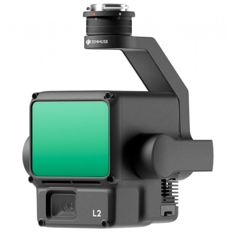
DJI Zenmuse L2 (1Y DJI care) mapping camera with LIDAR system (DJI-L2-1Y)
The Zenmuse L2 integrates frame LiDAR, a high-accuracy IMU system developed in-house, and a 4/3 CMOS RGB mapping camera. This integration enhances DJI flight platforms, enabling more precise, efficient, and reliable geospatial data acquisition. When paired with DJI Terra, it offers a comprehensive solution for 3D data collection and high-accuracy post-processing.
12200 $ net price (non-EU countries)
Viktoriia Turzhanska
Product Manager![]() /
/ ![]()
+48723706700![]() +48723706700
+48723706700![]() +48723706700
+48723706700
[email protected]
Anatolii Livashevskyi
Product Manager![]() /
/ ![]()
+48721808900![]() +48721808900
+48721808900![]() +48721808900
+48721808900
[email protected]
Description
The Zenmuse L2 integrates frame LiDAR, a high-accuracy IMU system developed in-house, and a 4/3 CMOS RGB mapping camera. This integration enhances DJI flight platforms, enabling more precise, efficient, and reliable geospatial data acquisition. When paired with DJI Terra, it offers a comprehensive solution for 3D data collection and high-accuracy post-processing.
Key Features:
High Precision:
- Vertical Accuracy: 4 cm
- Horizontal Accuracy: 5 cm
Exceptional Efficiency:
- Covers 2.5 km2 in a single flight
Superior Penetration:
- Smaller laser spots and denser point clouds
Detection Range:
- 250m @10% reflectivity, 100klx
- 450m @50% reflectivity, 0klx
Turnkey Solution:
- Point Cloud LiveView
- One-Click Processing on DJI Terra
Integrated LiDAR Solution:
The L2, supported by powerful hardware, enables precise scanning of complex subjects over an extended range and faster point cloud acquisition. Users can preview, playback, and process point cloud models on-site with DJI Terra, streamlining the workflow and improving overall efficiency.
High-Level Precision:
- Achieves 4cm vertical accuracy and 5cm horizontal accuracy through GNSS and high-accuracy IMU.
Exceptional Efficiency:
- Ready for immediate use, covering 2.5km2 in a single flight.
Intuitive Operation:
- Offers a user-friendly turnkey solution with Matrice 350 RTK and DJI Terra.
Frame-Based LiDAR:
- 30% increase in detection range, extending up to 450 meters.
- Smaller laser spots enable detection of finer details and penetration through dense vegetation.
Supports 5 Returns:
- Captures more ground points in densely vegetated areas.
Effective Point Cloud Rate:
- Reaches 240,000 pts/s for efficient data acquisition.
Two Scanning Modes:
- Provides flexibility for different tasks, ensuring uniform accuracy or deeper penetration based on requirements.
High-Accuracy IMU System:
- Real-time yaw accuracy of 0.2° and pitch/roll accuracy of 0.05°.
- No warm-up time required, enhancing operational efficiency.
RGB Mapping Camera:
- 4/3 CMOS with mechanical shutter, offering improved imaging and true-color point cloud details.
- Enhanced operational experience with diverse flight route types and Point Cloud LiveView.
PPK Solution:
- Offers post-processing kinematic process for rebuilding high-precision models in complex environments.
Application Scenarios:
- Suitable for land surveying, electricity, forestry, and infrastructure management, among other scenarios, when used with DJI Enterprise flight platforms and DJI Terra.
In the Box
- DJI Zenmuse L2 (1Y DJI care) × 1
- microSD Card (128GB) × 1
- Lens Cap × 1
- Storage Case × 1
- Lens Cleaning Cloth × 1
Specifications
Product Name: Zenmuse L2
Dimensions: 155×128×176 mm (L×W×H)
Weight: 905±5 g
Power: 28 W (typical), 58 W (max.)
IP Rating: IP54
Supported Aircraft: Matrice 300 RTK (requires DJI RC Plus), Matrice 350 RTK
Storage Temperature: -20° to 60° C (-4° to 140° F)
Operating Temperature: -20° to 50° C (-4° to 122° F)
System Performance
Detection Range:
450m @50% reflectivity, 0 klx
250m @10% reflectivity, 100 klx (Typical data. Measured using a flat subject with a size larger than the laser beam diameter, perpendicular angle of incidence, and an atmospheric visibility of 23 km. In low-light environments, the laser beams can achieve the optimal detection range. If a laser beam hits more than one subject, the total laser transmitter power is split, and the achievable range is reduced. The maximum detection range is 500 m.)
Point Cloud Rate:
Single return: max. 240,000 pts/s
Multiple returns: max. 1,200,000 pts/s
System Accuracy:
Horizontal: 5 cm @ 150 m
Vertical: 4 cm @ 150 m (Measured under specific conditions in a DJI laboratory environment.)
Real-Time Point Cloud Coloring: Coding Reflectivity, Height, Distance, RGB
LiDAR
Ranging Accuracy (RMS 1σ): 2 cm @ 150 m (Measured in a controlled environment.)
Maximum Returns Supported: 5
Scanning Modes: Non-repetitive scanning pattern, Repetitive scanning pattern
Field of View (FOV):
Repetitive scanning pattern: Horizontal 70°, Vertical 3°
Non-repetitive scanning pattern: Horizontal 70°, Vertical 75°
Minimum Detection Range: 3 m
Laser Beam Divergence:
Horizontal: 0.2 mrad
Vertical: 0.6 mrad (Measured at full width at half maximum (FWHM) conditions.)
Laser Wavelength: 905 nm
Laser Spot Size:
Horizontal: 4 cm
Vertical: 12 cm @ 100 m (FWHM)
Laser Pulse Emission Frequency: 240 kHz
Laser Safety Class: 1 (IEC 60825-1:2014)
Accessible Emission Limit (AEL): 233.59 nJ
Reference Aperture Effective Aperture: 23.85 mm (equivalent to circular)
Max Laser Pulse Emission Power Within 5 Nanoseconds: 46.718 W
Inertial Navigation System
IMU Update Frequency: 200 Hz
Accelerometer Range: ±6 g
Angular Velocity Meter Range: ±300 dps
Yaw Accuracy (RMS 1σ):
Real-time: 0.2°
Post-processing: 0.05° (Measured under specific conditions in a DJI laboratory environment.)
Pitch/Roll Accuracy (RMS 1σ):
Real-time: 0.05°
Post-processing: 0.025° (Measured under specific conditions in a DJI laboratory environment.)
Horizontal Positioning Accuracy: RTK FIX: 1 cm + 1 ppm
Vertical Positioning Accuracy: RTK FIX: 1.5 cm + 1 ppm
RGB Mapping Camera
Sensor: 4/3 CMOS, Effective Pixels: 20 MP
Lens:
FOV: 84°
Format Equivalent: 24 mm
Aperture: f/2.8-f/11
Focus Points: 1 m to ∞ (with autofocus)
Shutter Speed: Mechanical Shutter: 2-1/2000 s, Electronic Shutter: 2-1/8000 s
Shutter Count: 200000
Photo Size: 5280×3956 (4:3)
Still Photography Modes: Single shot: 20 MP, Timed: 20 MP, JPEG Timed Interval: 0.7/1/2/3/5/7/10/15/20/30/60 s, RAW/JPEG + RAW Timed Interval: 2/3/5/7/10/15/20/30/60 s
Video Codec and Resolution: H.264, H.265, 4K: 3840×2160 @30fps, FHD: 1920×1080 @30fps
ISO: Video: 100-6400, Photo: 100-6400
Video Bitrate: 4K: 85Mbps, FHD: 30 Mbps
Supported File System: exFAT
Photo Format: JPEG/DNG (RAW)
Video Format: MP4 (MPEG-4 AVC/H.264 or HEVC/H.265)
Gimbal
Stabilization System: 3-axis (tilt, roll, pan)
Angular Vibration Range: 0.01°
Mounting: Detachable DJI SKYPORT
Mechanical Range:
Tilt: -143° to +43°
Pan: ±105° (Structural limit, not controllable range.)
Controllable Range:
Tilt: -120° to +30°
Pan: ±90°
Operation Mode: Follow/Free/Re-center
Data Storage
Raw Data Storage: Photo/IMU/Point cloud/GNSS/Calibration files
Point Cloud Data Storage: Real-time modeling data storage
Supported microSD Cards:
microSD: Sequential writing speed 50 MB/s or above and UHS-I Speed Grade 3 rating or above
Max capacity: 256 GB
Recommended microSD Cards: Lexar 1066x 64GB U3 A2 V30 microSDXC, Lexar 1066x 128GB U3 A2 V30 microSDXC, Kingston Canvas Go! Plus 128GB U3 A2 V30 microSDXC, Lexar 1066x 256GB U3 A2 V30 microSDXC
Post-Processing
Supported Software: DJI Terra
Data Format: DJI Terra supports exporting point cloud models in the following formats: PNTS/LAS/PLY/PCD/S3MB
Data sheet

Official permits of the Ministry of Development and Technology
Our company is involved in preparing official permits from the Polish Ministry of Development and Technology, which allows us to export all dual-use drones, optics, and portable radiophones without VAT on the Polish side / and without VAT on the Ukrainian side.